 By
By 
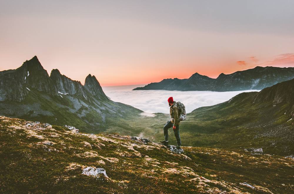
Norway is a country of stunning natural beauty, and hiking is a great way to experience it. If you're looking for a challenging hike with amazing views, then Norway is the perfect place for you.
In this blog post, I'll share my top 12 picks for the best hikes in Norway. These hikes range from moderate to very challenging, so there's something for everyone. I'll also include information about the location, difficulty, distance, and duration of each hike.
So whether you're a beginner or an experienced hiker, I hope you'll find a hike on this list that you'll love.
Pulpit Rock (Preikestolen)
- Location: Lysefjorden, Rogaland
- Difficulty: Moderate
- Distance: 4.8 kilometers (3 miles)
- Duration: 4-6 hours
- Best time to go: May-September
Pulpit Rock is a cliff that rises 600 meters (2,000 feet) above Lysefjorden fjord. The views from the top are simply stunning. You can see for miles in every direction, and on a clear day, you can even see the North Sea.
The hike to Pulpit Rock is moderate, but it's not too challenging. The trail is well-maintained, and it's easy to follow. The hike takes about 4-6 hours, depending on your pace.
The best time to go to Pulpit Rock is during the summer months, when the weather is warm and sunny. However, the hike is also possible in the spring and fall, when the weather is cooler.

Hiorthfjellet
- Location: Lofoten Islands, Nordland
- Difficulty: Challenging
- Distance: 7.5 kilometers (4.7 miles)
- Duration: 5-7 hours
- Best time to go: June-August
Hiorthfjellet is a mountain in the Lofoten Islands. The hike to the top takes you through lush forests, over steep cliffs, and past stunning waterfalls. The views from the top are simply amazing. You can see for miles in every direction, and on a clear day, you can even see the Arctic Ocean.
The hike to Hiorthfjellet is challenging, but it's worth the effort. The trail is not well-maintained, so you'll need to be prepared for some scrambling. The hike takes about 5-7 hours, depending on your pace.
The best time to go to Hiorthfjellet is during the summer months, when the weather is warm and sunny. However, the hike is also possible in the spring and fall, when the weather is cooler.

Kjeragbolten
- Location: Lysefjorden, Rogaland
- Difficulty: Challenging
- Distance: 4 kilometers (2.5 miles)
- Duration: 3-4 hours
- Best time to go: May-September
Kjeragbolten is a rock that's wedged between two cliffs, 1,000 meters (3,300 feet) above Lysefjorden fjord. The hike to Kjeragbolten is challenging, but it's an unforgettable experience.
The trail to Kjeragbolten starts at the Månafossen waterfall. The hike is steep and rocky, but the views are amazing. Once you reach Kjeragbolten, you can stand on the rock and look out over the fjord. It's an incredible feeling to be standing on a rock that's suspended in mid-air.
The best time to go to Kjeragbolten is during the summer months, when the weather is warm and sunny. However, the hike is also possible in the spring and fall, when the weather is cooler.

Måtind & the Stave-Bleik Coastal Trail
- Location: Helgeland, Nordland
- Måtind Norway
- Difficulty: Moderate
- Distance: 10 kilometers (6.2 miles)
- Duration: 5-6 hours
- Best time to go: June-August
Måtind & the Stave-Bleik Coastal Trail is a beautiful hike that takes you along the coast of the Helgeland region. The hike starts at the village of Stave, and it takes you to the top of Måtind mountain, with stunning views of the ocean. The hike is moderate, and it's a great way to experience the beauty of the Helgeland coast.
The trail starts at Stave and follows the coast for a few kilometers. Then, it takes you up to Måtind mountain. The views from the top are amazing. You can see for miles in every direction, and on a clear day, you can even see the Lofoten Islands.
The best time to go to Måtind & the Stave-Bleik Coastal Trail is during the summer months, when the weather is warm and sunny. However, the hike is also possible in the spring and fall, when the weather is cooler.

Segla
- Location: Senja, Troms og Finnmark
- Difficulty: Challenging
- Distance: 4 kilometers (2.5 miles)
- Duration: 3-4 hours
- Best time to go: June-August
Segla is a mountain in the Senja archipelago. The hike to the top takes you through lush forests, over steep cliffs, and past stunning waterfalls. The views from the top are simply amazing. You can see for miles in every direction, and on a clear day, you can even see the North Cape.
The hike to Segla is challenging, but it's worth the effort. The trail is not well-maintained, so you'll need to be prepared for some scrambling. The hike takes about 3-4 hours, depending on your pace.
The best time to go to Segla is during the summer months, when the weather is warm and sunny. However, the hike is also possible in the spring and fall, when the weather is cooler.

Munken
- Location: Geirangerfjord, Møre og Romsdal [Image of Munken Norway]
- Difficulty: Challenging
- Distance: 1.5 kilometers (0.93 miles)
- Duration: 2-3 hours
- Best time to go: June-August
Munken is a small island in Geirangerfjord. The hike to Munken is challenging, but it's worth the effort. The views from the top are simply amazing. You can see the entire Geirangerfjord, including the Seven Sisters waterfall and the Bridal Veil waterfall.
The hike to Munken starts at the village of Geiranger. The trail is steep and rocky, but it's well-maintained. The hike takes about 2-3 hours, depending on your pace.
The best time to go to Munken is during the summer months, when the weather is warm and sunny. However, the hike is also possible in the spring and fall, when the weather is cooler.

Reinebringen
- Location: Reine, Lofoten Islands [Image of Reinebringen Norway]
- Difficulty: Challenging
- Distance: 2 kilometers (1.24 miles)
- Duration: 2-3 hours
- Best time to go: June-August
Reinebringen is a mountain in the Lofoten Islands. The hike to the top takes you through lush forests, over steep cliffs, and past stunning waterfalls. The views from the top are simply amazing. You can see the entire Reinefjord, including the Reinebringen mountain itself.
The hike to Reinebringen is challenging, but it's worth the effort. The trail is not well-maintained, so you'll need to be prepared for some scrambling. The hike takes about 2-3 hours, depending on your pace.
The best time to go to Reinebringen is during the summer months, when the weather is warm and sunny. However, the hike is also possible in the spring and fall, when the weather is cooler.

Galdhøppigen
- Location: Jotunheimen National Park, Oppland [Image of Galdhøppigen Norway]
- Difficulty: Very challenging
- Distance: 11 kilometers (6.84 miles)
- Duration: 8-10 hours
- Best time to go: June-August
Galdhøppigen is the highest mountain in Norway. The hike to the top is challenging, but it's worth the effort. The views from the top are simply amazing. You can see for miles in every direction, and on a clear day, you can even see the North Sea.
The hike to Galdhøppigen is very challenging, so it's important to be prepared. The trail is not well-maintained, so you'll need to be prepared for some scrambling. The hike takes about 8-10 hours, depending on your pace.
The best time to go to Galdhøppigen is during the summer months, when the weather is warm and sunny. However, the hike is also possible in the spring and fall, when the weather is cooler.

Trolltunga
- Location: Hardangervidda National Park, Hordaland [Image of Trolltunga Norway]
- Difficulty: Very challenging
- Distance: 28 kilometers (17.4 miles)
- Duration: 12-14 hours
- Best time to go: June-August
Trolltunga is a rock that juts out over a cliff, 700 meters (2,300 feet) above the ground. The hike to Trolltunga is challenging, but it's an unforgettable experience.
The trail to Trolltunga starts at the village of Tyssedal. The hike is steep and rocky, but the views are amazing. Once you reach Trolltunga, you can stand on the rock and look out over the valley. It's an incredible feeling to be standing on a rock that's suspended in mid-air.
The best time to go to Trolltunga is during the summer months, when the weather is warm and sunny. However, the hike is also possible in the spring and fall, when the weather is cooler.

Romsdalseggen Ridge
- Location: Romsdal, Møre og Romsdal
- Difficulty: Moderate
- Distance: 10 kilometers (6.2 miles)
- Duration: 5-6 hours
- Best time to go: June-August
Romsdalseggen Ridge is a beautiful hike that takes you along the top of a ridge with stunning views of the Romsdal valley. The hike is moderate, and it's a great way to experience the beauty of the Romsdal region.
The trail starts at the village of Valldal and follows the ridge for a few kilometers. Then, it takes you down to the valley floor. The views from the top are amazing. You can see for miles in every direction, and on a clear day, you can even see the Sunnmøre Alps.
The best time to go to Romsdalseggen Ridge is during the summer months, when the weather is warm and sunny. However, the hike is also possible in the spring and fall, when the weather is cooler.

Ryten & Kvalvika Beach
- Location: Lofoten Islands, Nordland
- Difficulty: Moderate
- Distance: 3.5 kilometers (2.17 miles)
- Duration: 3-4 hours
- Best time to go: June-August
Ryten & Kvalvika Beach is a beautiful hike that takes you to the top of a mountain and to a secluded beach. The hike is moderate, and it's a great way to experience the beauty of the Lofoten Islands.
The trail starts at the village of Kvalvika and takes you up to Ryten mountain. The views from the top are amazing. You can see for miles in every direction, and on a clear day, you can even see the Vestfjorden.
From Ryten, you can continue on to Kvalvika Beach. The beach is a beautiful cove with white sand and crystal-clear water. It's a great place to relax and enjoy the scenery.
The best time to go to Ryten & Kvalvika Beach is during the summer months, when the weather is warm and sunny. However, the hike is also possible in the spring and fall, when the weather is cooler.

Stetind
- Location: Tysfjord, Nordland
- Difficulty: Very challenging
- Distance: 16 kilometers (10 miles)
- Duration: 10-12 hours
- Best time to go: June-August
Stetind is a mountain in the Tysfjord region of Norway. The hike to the top is challenging, but it's worth the effort. The views from the top are simply amazing. You can see for miles in every direction, and on a clear day, you can even see the North Cape.
The hike to Stetind is very challenging, so it's important to be prepared. The trail is not well-maintained, so you'll need to be prepared for some scrambling. The hike takes about 10-12 hours, depending on your pace.
The best time to go to Stetind is during the summer months, when the weather is warm and sunny. However, the hike is also possible in the spring and fall, when the weather is cooler.

Svolvaer Fløya & Svolvaergeita
- Location: Svolvaer, Lofoten Islands
- Svolvaer Fløya Norway
- Difficulty: Moderate
- Distance: 5 kilometers (3.1 miles)
- Duration: 4-5 hours
- Best time to go: June-August
Svolvaer Fløya & Svolvaergeita is a beautiful hike that takes you to the top of a mountain and to a distinctive rock formation. The hike is moderate, and it's a great way to experience the beauty of the Lofoten Islands.
The trail starts in the town of Svolvaer and takes you up to Svolvaer Fløya mountain. The views from the top are amazing. You can see for miles in every direction, and on a clear day, you can even see the Vestfjorden.
From Svolvaer Fløya, you can continue on to Svolvaergeita. Svolvaergeita is a distinctive rock formation that looks like a goat's horn. It's a great place to take pictures and enjoy the scenery.

Discovering the best hikes in Norway
Hiking in Norway is an unforgettable experience. The stunning scenery, the challenging hikes, and the sense of accomplishment are all worth the effort. If you're looking for a great way to see Norway, then I highly recommend hiking.
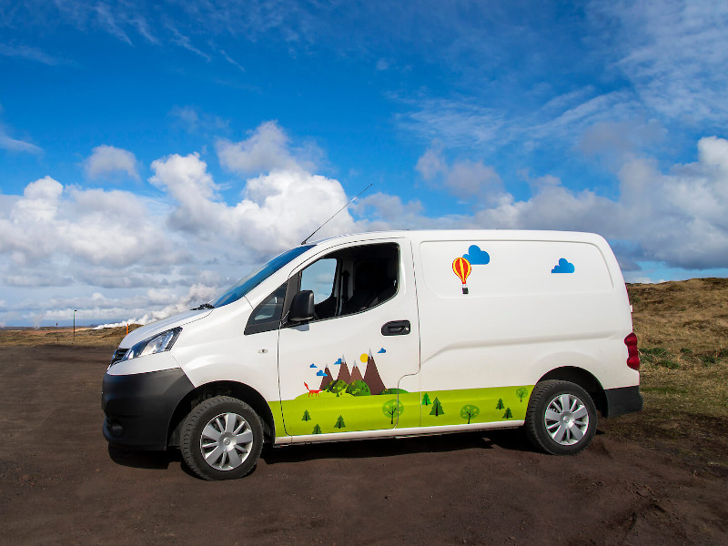
I hope this blog post has inspired you to plan your next hiking trip to Norway. Be sure to check out the 12 hikes I've listed. Rent your campervan in Norway and I'm sure you'll find one that's perfect for you.